Impressions: Kanab Creek to Deer Creek loop is a very ambitious backpacking trip. It fundamentally traces a circle around Fishtail Mesa. While nothing comes to technical (there is one semi-climb near the end that is interesting in the snow), there are long, dry distances, route finding around pour-offs, slot canyons, boulder hopping, many stream crossings with nearly unavoidable feet-wetting, route-finding, boulder-hopping, avoiding getting cliffed-out, precarious ledges, and thousands (about 5,000) of feet of elevation change. That said, it is a great trip for experienced, fairly fast, and upbeat backpackers. There is great variation in the scenery with optional side trips into Whispering Grotto (Featured) and Deer Creek Falls (Not this time). Time-warp slot canyons transition into one of the largest side canyons to the Grand Canyon. There are springs and waterfalls as you follow the creek to the Colorado River itself. The Grand Canyon has all of its majesty as you pick your way along the river under the red cliffs of the Redwall, past rapids, side canyons, and contour along Tapeats cliffs and into the slot canyon of Deer Creek. The Thunder River trail features a legendary climb up the Redwall via a massive pile-up of Supai/Shale, the rolling, slick-rock wonder of the Esplanade and a steep ascent up the sandstones to panoramic views of the canyon and Fishtail Mesa.
Route Details: This rout went from the Jump Up/Naile trailhead in the Kanab Creek Wilderness to the Kwagunt Hollow Rout. Then, it descends into Jump Up Canyon which feeds into Kanab Canyon. It then follows Kanab Canyon all the way to its confluence with the Colorado River. From there, turn upstream and follow the route-ish along the river to Deer Creek. This puts you back on trails to go up Deer Creek, through Surprise Valley, up to the Esplanade, and finally up the Bill Hall Trail to Monument Point. It is about 39 miles total, which we did in four days: 14 mi. to Showerbath Springs, 8 mi. to the Colorado River, 7 mi. to Deer Creek, and 10 mi. to Monument Point. This is on the fast side for a hike such as this.
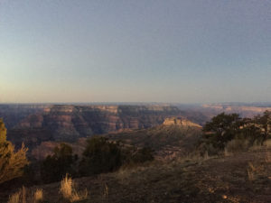
Specific Trip: We had a group of four excellent hikers for this trip. It started with a late-night drive into Monument Point after 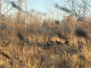 Thanksgiving dinner. We camped at Monument Point and then convened for the carpool to Jump Up/Naile Trailhead. The drive featured ALL of the wildlife including two small groups of deer, the usual assortment of small animals, and at least forty Turkey. Also, there was a lot of mud as we trundled through wet spots in the road.
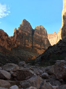
The first day of hiking featured a trail descent of the whitewall to Kwagunt Hollow which is right past the first set of cottonwood trees. There is a carin (one of only two in the next two days) that marks the 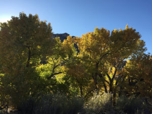 departure from the trail onto the Kwagunt Hollow route. We followed the hollow down the slick-rock shelves and around several pour-offs. Having had a rainstorm pass through a week before, there were still may puddles that set off neat reflections of the cliffs and blue skies above.
We merged into Jump Up Canyon just before it delves into the time-warp slot canyon that is almost exactly the same
width and apparent height for the next six miles, broken onl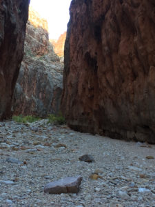 y by the entrance of the Indian Hollow slot canyon from the East. These are slot canyons in their truest form and evoke images of the chasms below the broken lands of Brandon Sanderson’s Way of Kings series. It is certainly not the place to be in a storm as there is no higher ground to retreat to in a flash flood. The similarity of the canyon as it winds around makes it hard to judge progress, but the walking was relatively easy. As most descents through the Redwall are precipitous, it was very interesting to have a gradual slope for miles. One can really appreciate the beauty of the sheer cliffs, even if lunch was in the shade and cold (given
 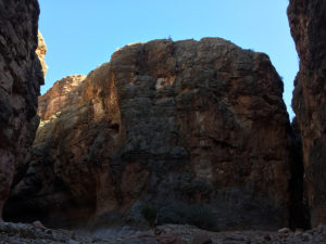 November, not the blistering summer heats). Finding the first sun since entering the slot two minutes after continuing was…um…welcome?
Anyway, Jump Up canyon joined with Kanab and a relatively high-flowing creek in that there was actually water from the confluence on. The rest of the day was spent in the wider canyon that is Kanab Creek. We did manage to keep our feet mostly dry this day as we weaved back and forth and eventually made it to Showerbath Springs.
 Clearly, we are good at naming things as the water comes down as though from a showerhead, and it made a peaceful camp to have the sounds of the stream and spring. There were various spots to pitch the tent and watch the stars come out over my nearly-calorie-deficient backpacking meal at only 420 calories. We relaxed, shared treats, and socialized about the day and the excitement for the next few days, happy to be done the longest of the four.
Day two was leisurely (This is a lie. I made the comment of the day the night before and in the morning because it was only to be eight miles and a mere 600 feet of elevation change. “You keep on using that word. I do not think it means what you think it means.”).
 Day two was a great day if you enjoy following creeks, wading through them (water became unavoidable at mile mark 100 yards), scrambling over boulders and otherwise covering rough terrain with a backpack. Both Scotty’s Castle and False Scotty’s Castle were amazing formations in the middle of the many horseshoe bends we encountered (the first is real because it also has Scotty’s Hollow across from it). Fall was happening in the canyon, and the unexpected presence of Virginia Creeper Parthenocissus quinquefolia added shades of red and orange to the yellows of the cottonwoods and tamarisks.
  The creek was beautiful and briefly became silty before returning to what can only be described as “so clear you have to look carefully to see where the water actually is”. The slow descent through the Redwall continued and featured many pour-ins from various side canyons as we wandered along. Eventually we came to some Tapeats formation bedrock that features the strange features of rocks that entirely turn to mud, looking almost like bricks that have yet to be fired. There were also a few walkways that function as natural sidewalks with the water flowing next to us in culverts of its own making, and boulders. Lots of them. We had to climb up and around, duck under, and repeatedly cross the creek to get around the massive stones with only a vague impression of the mighty force of water that deposited them there.
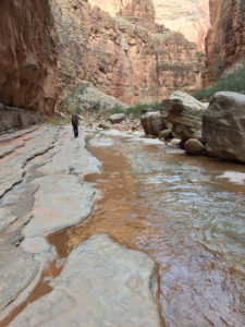
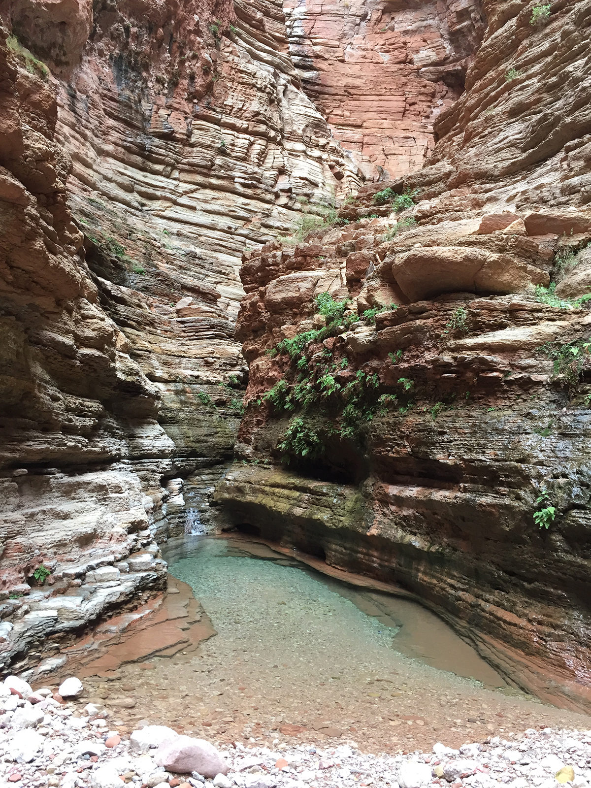
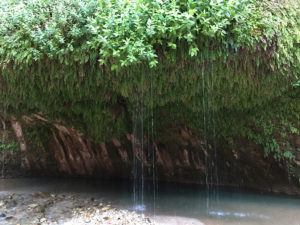
In the mid-afternoon, we came to Whispering Grotto, where we shrugged off our packs to head into the side canyon and hidden grotto itself. Losing the pack was great and made us feel rejuvenated, renewed, and in my case, a little giddy. We scrambled (and hopped/leaped) up the canyon past a few small, trickling waterfalls and flat-rock benches to the grotto. Th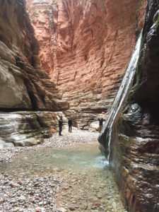 is was guarded by a still, slightly blue pool of water. Entrance was gained
only by shuffling along with the toes of
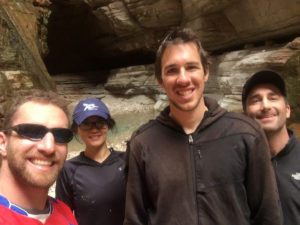
our feet on the miniature terraces of rocks and then shifting back and forth over the stream to climb into the grotto. Water was dripping from above as well as gliding down a long slide of its own making. The pool was not as deep as remembered, but the enclosed feeling of the place gave a sense of its seclusion from all the world. Looking up one can see how small we people really are. Plus, selfie (the only one of all of us for the trip).
The day finished with more boulder hopping, the return of hope (leisurely, remember) as the last mile was, as remembered, easier, and a strange sense of timelessness when I looked at a rock and remembered looking at that exact same rock over ten years ago. True to form for the 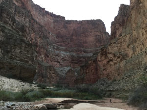 entire trip though, not a single day ended easily with the route having one last challenge to throw our way (mud. So much mud right at the end!) before we could relax and joke about who would be deficient in calories for their meal for the day.
10:37 p.m.: a huge windstorm came out of nowhere. The weather had been calm up to this point with the barest hint of clouds presaging the forecasted storm coming in for the end of the weekend. This wind blew so hard the sand from the beach was coming under the fly, through the mesh  and into the tent. It broke one of the pole joints for Yao and Ryan’s tent forcing a retreat to the trees, and it almost blew my shoes into the river 17 miles from the nearest trailhead. Chris and I couldn’t really get out of the tents as the pegs had already pulled out of the ground and our weight was really the only thing holding the tents down. Still, mine was blown almost a foot.
My theory is that the incoming weather system caused an air sink into the canyons, and we did happen to be camping at the mouth of the second largest canyon one can hope to find leading into the Grand Canyon itself.
Day three: The book describes this as a half-day of pleasant boulder hopping (This is a lie, but the description of the trip as both leisurely and pleasant had stuck by this point. And so it remained throughout the day. The trip was certainly awesome every single day, and the sights and company amazing. Morale was generally high despite the very real physical challenges of each day and the persistent last-challenge-before-the-end syndrome).
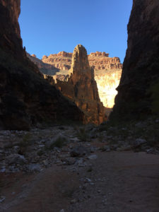
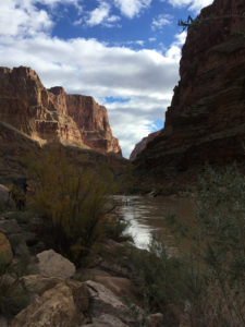
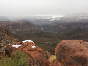
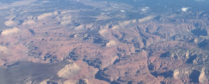
The route along the river was last frequented by a big horn sheep if that gives you an idea of its quality. Thus there was a certain amount of finding paths that are as wide as a single foot if lucky. Fortunately, there was the very definite boundary to the world as there is the river on the right and the Redwall cliffs on the left. Just don’t look at what appears to be a perfectly flat and clear sand walkway on the opposite side of the river. The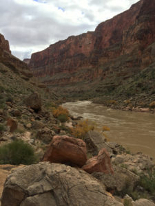 Colorado is deceptively dangerous and very, very cold. There were a fair number of cairns, and these generally marked the easiest of the route possibilities, but even as experienced route-finders, we got off route a lot. This was fine as it just meant we had to pay more attention to our feet and have bigger boulders to scale. Up to the point of Fishtail canyon was fairly uniform, though there was a steeper boulder field as we came around the riverbend. The views were constantly that great vista of the grand river in the southwest. The full majesty of the canyon was visible glancing up the side canyons and seeing the rim beyond what looks like the original boundaries of the canyon. The hiss and
 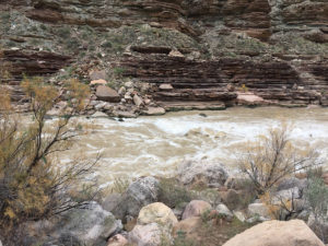 whirl of the river as we moved along was a welcome and strange sound. Occasionally, such as at lunch at Fishtail Canyon, we got the roar of the rapids, and sound that is at once full of energy and tranquil.
The latter half of the hike had more following of Tapeats formations and clearly defined routes so that it was faster and generally easier going. There was even a spring enjoyed high above the river. There was a very steep descent off one set of cliffs that is more technical, and another set of cliffs probably had a route along the bottom. However, we went over the cliffs fol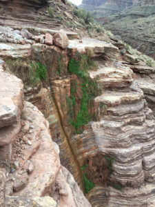 lowing some erroneous cairns and found a very dicey track that contours around a slippery gravel slope right above the cliffs. The heart started pounding, and the first rains of the trip began right at this point which was most everyone’s lowest point. We then had to descend a gully back to the route, but it remained straightforward the rest of the way to Deer Creek. The last part of this headed up along the slope to join the Deer Creek Trail after it had climbed up from the falls. Bonus: we didn’t have to climb the steepest part of that trail. Minus: we didn’t get to see Deer Creek Falls at the end of a long day.
The trail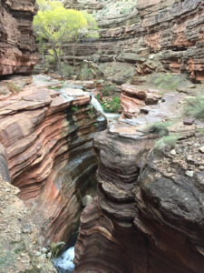 above the narrows was still precipitous and beautiful as the winding slot canyon traced swirls in the patterns of the sandstone, and we soon found ourselves alone in the camp. We claimed a nice spot and set up tents in the light rain that had settled in. Dinner was merry under the tarp as only the contentment of a hard day hiking can be rewarded with dinner and a raspberry desert upped in decadence with chocolate caramels.
 Day four: This was a push to get out the ten miles to the rim with the motivation of getting home at a reasonable hour, not getting stuck in the snow, and most importantly: victory meals. We cruised at a very good pace as the trail is maintained, and soon wound out of Deer Creek, through the scrubland of Surprise Valley and up the Redwall. There were some very brief stops to reconvene the group and wring out a wet sock or two, but mostly slow and steady was the
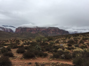 theme of the day. The climb up the Redwall was steep and full of giant Supai boulders; it rained or snowed for each ascent and pretty much stopped on the flatter parts of the hike. No exception was a light rain on the climb to the Esplanade that changed to snow right as we got to the top.
The Esplanade was a fairy-tale land of slickrock and scrub in the snow. It continued a subtheme of being able to experience many different wonders of the southwest: The slot canyons of the first day were very 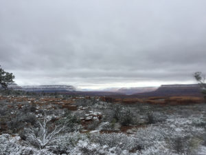 reminiscent of the Maze District of Canyonlands. The canyons and springs of Day two reminded me of areas in Zion and the Little Colorado Canyons; Day Three was the Grand Canyon, yet also the Colorado River just north of Moab. The Esplanade was much of the best Sedona has to offer.
The final push came in the ascent of the whitewall Coconino sandstone. It was steep, snowy and fatigue was definitely telling on us. We soldiered on 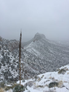 following the footprints of a lone pair of travelers ahead of us and gradually made our way up to the one semi-climb. Honey stinger gummies were a theme to keep moral high, and the canyon is so amazingly beautiful in the snow. We did catch the couple of people ahead of us shortly after the climb, a bedraggled looking group that was close enough to the end to rest assured that they would make it out, even if they asked accusingly “What is THIS?” of the snow.
We made the top to a good several inches of snow, but more importantly changes of clothes, warm cars, and victory. A good and challenging hike all around.
Logistics: For this trip, you have to fill out a form for the Grand Canyon National Park backcountry office. This form needs to be downloaded and filled out with the LA9, AX9, and AZ7 backcountry use areas for camping. The national park will most likely send “the doubt” form to you to fill out about your hiking experience, equipment, and identifying features such as back pack color and vehicle plates (in case you die. They also print “Aggressive itinerary. Hiker insisted on this itinerary” on your permit so the person who finds your body won’t feel bad for you). Cost of permits are $10 plus eight dollars per person per night camping below the rim of the canyon.
Carpooling with four-wheel drive, high clearance vehicles is required to Monument Point’s car drop and to the Jump Up/Naile Trailhead. These are both on the North Rim of the Grand Canyon, west of Jacob Lake (a fine place for victory meals after the trip). There are various routs you can take to get to the area and much of that choice depends on the weather (we had snow which changed our exit route). Driving is about 1:30 to 2:00 hours on the back roads after you get to Jacob Lake. Nearest Gas: Jacob Lake. Nearest notable settlements with more than a gas station and lodge: Fredonia, Kanab, Flagstaff, Paige (all of which are hours of driving).